By Editorial Staff | Peru Construye
In a proactive effort to fortify regional resilience against the looming threats posed by climate change and recurring weather patterns, the Geological, Mining, and Metallurgical Institute (Ingemmet) has officially launched a comprehensive field operation across the Department of Tumbes. This strategic initiative, which involves the deployment of expert geological brigades, is aimed at updating the regional inventory of critical areas susceptible to landslides, debris flows (huaicos), and catastrophic flooding.
As Peru faces the persistent volatility of the El Niño phenomenon, this scientific endeavor represents a critical pillar in the government’s disaster risk reduction strategy. By mapping the most vulnerable terrains across all 13 districts of Tumbes, Ingemmet aims to provide local and national authorities with the empirical data necessary to execute life-saving preventative infrastructure projects.
1. Main Facts: A Scientific Approach to Regional Safety
The initiative, officially commenced in mid-August, is not merely a survey but a high-precision diagnostic mission. Ingemmet’s technical teams are tasked with identifying geodynamic hazards that threaten the structural integrity of residential sectors, major transportation arteries, and essential public services.
The primary objective is the production of a granular, high-resolution risk map. Unlike previous studies, this updated assessment will incorporate modern geotechnical data, accounting for recent soil erosion patterns and current hydrological trends in the Tumbes River basin. The findings will serve as the primary roadmap for municipal and regional governments to prioritize investments in desilting (descolmatación), slope stabilization, and the construction of containment walls.
Key takeaways from the project include:

- Operational Scope: Coverage of all 13 districts within the Tumbes region.
- Duration: A rigorous field phase spanning from August 13 to September 17.
- Technical Focus: Identification of zones at high risk for mass wasting (landslides) and hydrological surges.
- Strategic Goal: To translate geological data into actionable policy for immediate disaster mitigation.
2. Chronology of the Field Operation
The execution of this mission is structured in a multi-phase framework designed to ensure maximum coverage and technical accuracy.
Phase I: Preparation and Logistical Coordination (Late July – Early August)
Prior to the deployment of field brigades, Ingemmet held a series of high-level meetings with regional authorities and civil defense representatives. These meetings served to align local knowledge of past disaster events with the institute’s satellite-based preliminary risk models.
Phase II: The Field Deployment (August 13 – September 17)
The core of the operation is the physical inspection of the territory. Geologists are currently traversing the diverse landscapes of Tumbes—from its coastal plains to the foothills of the Andean slopes. This phase involves the collection of soil samples, the analysis of rock stability in potential slide areas, and the evaluation of drainage channels that have historically been prone to obstruction.
Phase III: Data Integration and Reporting (Late September – October)
Following the completion of the field work, the collected data will be processed through advanced Geographic Information Systems (GIS). By late October, a comprehensive scientific report will be delivered to the Tumbes Regional Government and the National Institute of Civil Defense (INDECI).
3. Supporting Data: Why Tumbes is a Priority
The Tumbes region presents a unique geographical challenge. Its proximity to the Pacific Ocean and its complex river systems make it exceptionally sensitive to the oscillations of the El Niño phenomenon. Historically, the region has faced severe disruptions during intense rainy seasons, where rapid saturation of the soil leads to widespread flooding and the destruction of the agricultural backbone of the area.
Data gathered by previous Ingemmet reports indicates that:

- Soil Composition: Much of the region is characterized by unconsolidated sediments that are highly susceptible to liquefaction and erosion during prolonged precipitation.
- Topographic Risk: The transition zones between the foothills and the lowlands are primary corridors for debris flows, which move with significant kinetic energy, often burying infrastructure in a matter of minutes.
- Infrastructure Vulnerability: A significant portion of rural roads in the 13 districts lacks the modern drainage capacity required to withstand the high-volume water discharge associated with extreme meteorological events.
By updating the risk map, Ingemmet is effectively providing a "hazard warning system" that allows the state to transition from a reactive stance—often involving costly emergency response—to a proactive stance characterized by structural prevention.
4. Official Responses and Stakeholder Engagement
The collaboration between Ingemmet and local leadership has been met with significant approval from both administrative officials and the affected populations.
"The work being done by the geologists is the first line of defense for our families," stated a representative from the regional administration during the project’s inauguration. "We have seen too many times how a lack of updated data delays the implementation of essential public works. By having these maps, we can guarantee that every sol invested in prevention is directed exactly where it is needed most."
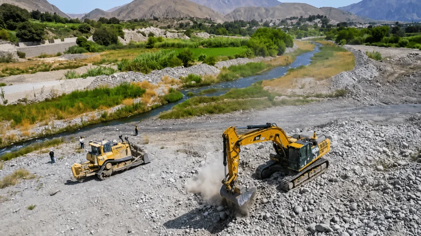
Furthermore, the collaboration includes a significant emphasis on "descolmatación" (the clearing of riverbeds). Through coordination with the Ministry of Agrarian Development and Irrigation (MINAGRI), the geological findings will inform where mechanical dredging is most urgent, ensuring that water channels can handle increased volumes during peak rainy months without overflowing into neighboring communities.
5. Implications: The Path Toward Resilient Development
The implications of this study extend far beyond the immediate mitigation of disasters. They touch upon the core of long-term urban and rural planning in northern Peru.
Mitigating Economic Loss
Disasters in Tumbes do not only result in human tragedy; they cause massive economic setbacks. The destruction of crops, the isolation of communities due to road collapses, and the loss of livestock have historically stifled the regional economy. A scientifically backed map allows for the "smart planning" of future settlements, steering development away from high-risk floodplains and unstable slopes.

Enhancing Public Policy
With a validated scientific document in hand, municipal leaders are better positioned to request national funding. It provides a legal and technical justification for the reallocation of budgets, ensuring that disaster prevention is treated as a priority item on the national fiscal agenda.
A Model for Other Regions
The methodology employed by Ingemmet in Tumbes is intended to serve as a blueprint for other vulnerable departments across the Peruvian coast and highlands. By standardizing the way geological risk is assessed, the government is building a nationwide "Culture of Prevention."
Final Thoughts: A Proactive Future
As the geological brigades continue their work through September, the people of Tumbes remain at the center of this mission. The integration of high-level scientific expertise with community-level safety needs is the hallmark of a modern, responsive government.
The upcoming report will not only be a document of technical findings; it will be a tool for empowerment. It gives the people of Tumbes the knowledge they need to demand better safety standards and provides the government with the roadmap to prevent history from repeating itself. As the climate becomes increasingly unpredictable, these efforts by Ingemmet are not just timely—they are essential to the survival and prosperity of the region.
The mission remains clear: to turn geological foresight into tangible safety, ensuring that Tumbes is prepared to face whatever weather the future may hold.