In an era defined by climate volatility and the increasing frequency of extreme weather events, the paradigm of emergency management is shifting from reactive containment to proactive anticipation. As nations grapple with the escalating threats of torrential rains, flash floods, and seismic instability, the integration of advanced technology has become a non-negotiable imperative. Among the most transformative tools in this arsenal are specialized drones—unmanned aerial systems (UAS) that are moving beyond recreational use to become critical infrastructure for civil protection and disaster mitigation.
Main Facts: The New Frontier in Risk Management
The deployment of specialized drones is fundamentally changing how governments and private entities interact with vulnerable landscapes. Unlike traditional manual inspections, which are often hampered by geographical barriers, human physical limitations, and the sheer scale of the affected areas, drones provide a high-resolution, real-time "eye in the sky."
These aerial platforms are capable of conducting rapid mapping, structural analysis, and topographical monitoring with a level of precision that was previously unattainable. By utilizing high-definition sensors, LiDAR technology, and thermal imaging, these devices transform raw environmental data into actionable intelligence. This transition from raw observation to data-driven decision-making is the cornerstone of modern disaster risk reduction (DRR).
Chronology: The Evolution of Aerial Monitoring
The transition of drones from industrial novelty to essential safety equipment has occurred in three distinct phases:

- The Exploratory Phase (Early 2010s): Initial adoption was limited to basic photography and simple aerial surveying for mining and agricultural purposes. The utility for disaster management was recognized in theory but hampered by battery life, connectivity issues, and lack of specialized software.
- The Integration Phase (2015–2020): With the advent of more robust flight controllers and improved GPS stabilization, drones began to be utilized for post-disaster assessments. During this period, emergency services started using aerial imagery to identify the extent of flood damage or the blockage of critical mountain passes.
- The Predictive/Proactive Phase (2021–Present): Today, we are in the era of persistent monitoring. Drones are now part of regular, planned inspection cycles. By creating digital twins of rivers, dams, and urban perimeters, authorities can identify minute changes—such as early-stage soil erosion or the narrowing of water channels—before a catastrophe occurs.
Supporting Data: The Efficiency of Aerial Solutions
The technical superiority of drones in disaster scenarios is supported by measurable metrics in speed and scope:
- Geographic Coverage: Fixed-wing drone systems can survey hundreds of hectares in a single flight mission. This allows for the rapid assessment of entire river basins or vast agricultural regions that would take ground crews weeks to traverse.
- Time-to-Data: In emergency situations, the gap between the event and the availability of data is critical. Drones can capture and process photogrammetric data in a fraction of the time required for traditional satellite imagery or ground-based surveying.
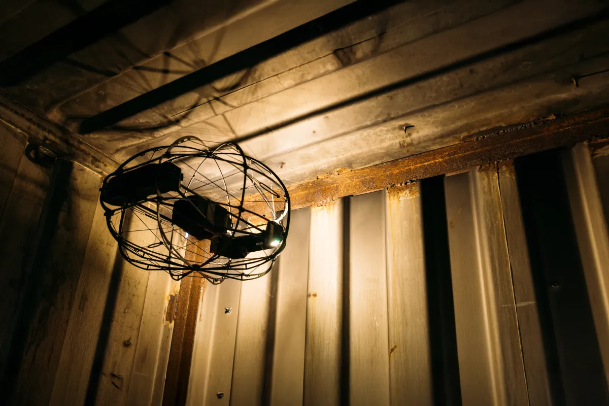
- Safety Thresholds: The use of drones in "confined spaces" (such as unstable buildings or deep ravines) eliminates the need for initial human entry. Research indicates that the use of specialized "cage" drones (Flybotix or similar technology) reduces the risk of injury to first responders by providing visual clearance before any personnel enter a danger zone.
The Role of Specialized Technology: Beyond the Visual
The effectiveness of these systems relies on the specific type of technology deployed:
Fixed-Wing Drones for Wide-Area Surveillance
These units are the workhorses of disaster prevention. By mimicking the flight dynamics of airplanes, they stay airborne longer and cover significantly more ground than multi-rotor drones. They are the ideal tool for monitoring the health of levees, the integrity of bridges, and the accumulation of debris in river basins that could cause future flooding.
Confined-Space Drones for Structural Integrity
Following a seismic event or a major structural collapse, rescue teams face the "unknown." Drones equipped with collision-avoidance sensors and high-intensity lighting can navigate into collapsed buildings or unstable tunnels. These drones act as the "advance guard," relaying live video to engineers and rescue teams, allowing them to assess structural stability and identify potential victim locations without putting rescuers in harm’s way.

Official Responses and Industry Perspectives
Mining & Construction Intelligence (MCI), a firm at the forefront of this technological shift, emphasizes that the true value of the drone is not the hardware itself, but the information it unlocks.
"The objective is not to use a drone for the sake of using technology," representatives from MCI state. "The true value lies in obtaining data that allows us to act before an event occurs, work with higher security standards, and take decisions based on precise, empirical evidence."
This sentiment is echoed by international disaster management agencies, which are increasingly viewing drone pilots as a core component of emergency response teams. The ability to "see before acting" is shifting the budget focus from disaster recovery to pre-emptive mitigation, which is statistically proven to be far more cost-effective.
Implications for Future Policy and Strategy
The implications of this technology are far-reaching for urban planning, agriculture, and infrastructure maintenance:

1. Data-Driven Urban Planning
By utilizing the historical data gathered from recurring drone flights, urban planners can restrict development in zones prone to flooding or soil instability. The visual record provided by drones serves as an irrefutable argument for zoning laws that prioritize public safety.
2. Streamlining Emergency Response
In the event of a disaster, the immediate deployment of a drone swarm can provide a bird’s-eye view of road blockages, allowing logistics teams to route aid effectively. This prevents the bottlenecking of resources, which is a common failure point in large-scale relief operations.
3. Bridging the Gap Between Industry and State
The expertise found in private sector entities like MCI should be leveraged by public institutions. Governments are encouraged to form public-private partnerships that allow for the rapid mobilization of professional drone fleets during national emergencies.
Conclusion: A Proactive Future
The challenge ahead is not one of technological availability, but of integration. The tools are ready, the sensors are precise, and the methodology is sound. The next critical step is for municipal and national authorities to embed these aerial monitoring systems into their standard operating procedures.

In the high-stakes environment of natural disaster management, time is the only currency that matters. When a river begins to swell or the ground shows the first signs of shifting, the ability to see the danger clearly—and from a safe distance—is the ultimate advantage. By embracing these specialized aerial solutions, we move closer to a world where disaster prevention is no longer a hopeful strategy, but a daily reality.
As the saying goes, "Ver antes es actuar mejor" (To see before is to act better). By investing in this technology today, we ensure that when the next challenge arrives, our response is not only faster but fundamentally more effective.