In a world where natural disasters strike without warning, the ability to shave even a few seconds off the response time can mean the difference between life and death. For residents of regions like Peru, located squarely within the volatile "Ring of Fire," the constant threat of seismic activity is an inescapable reality of daily life. As technology advances, digital tools are shifting from mere conveniences to critical components of emergency preparedness. Among these, the Google Earthquake Alert System has emerged as a silent guardian, transforming millions of Android smartphones into a global, crowdsourced network of early-warning sensors.
This report explores the mechanics behind this technology, how it functions as a modern-day sismograph, and why it is becoming an indispensable resource for public safety in high-risk zones.
The Mechanics of Detection: How Google Transforms Smartphones into Sensors
At the heart of Google’s Earthquake Alert System lies a sophisticated application of existing hardware. Every modern Android smartphone is equipped with a small, low-power component known as an accelerometer. Traditionally, these sensors were designed to detect the orientation of your device, allowing the screen to rotate when you tilt your phone or tracking your steps for fitness applications.
However, Google engineers realized these sensors were capable of much more. When a seismic event begins, the primary waves (P-waves)—the first, fastest, and often least destructive waves generated by an earthquake—vibrate through the earth’s crust. If a significant number of Android devices in a specific area detect these vibrations simultaneously, the Google system processes this data to identify a seismic event.
The Global Network
The system functions as a massive, decentralized sismograph. By leveraging the more than two billion Android devices currently in circulation worldwide, Google has created the world’s largest earthquake detection network. When a device senses a potential earthquake, it sends a signal to a central server, which analyzes the data from multiple phones in the vicinity. This triangulation allows the system to determine the epicenter, estimate the magnitude, and predict the areas likely to be affected by the subsequent, more destructive S-waves (secondary waves).
Chronology of a Warning: From Detection to Alert
The efficiency of this system rests on the speed of light versus the speed of sound (or seismic waves). Because electronic signals travel at the speed of light—far faster than the shockwaves of an earthquake moving through bedrock—Google can issue an alert to users in outlying areas before the shaking begins.
- The Trigger: A seismic event occurs. The P-waves travel outward from the hypocenter.
- The Detection: Android devices near the epicenter pick up the initial vibrations via their accelerometers.
- The Processing: Anonymized data is sent to Google’s servers, which cross-reference the input with other devices. If the data patterns match a seismic event, the system confirms the alert.
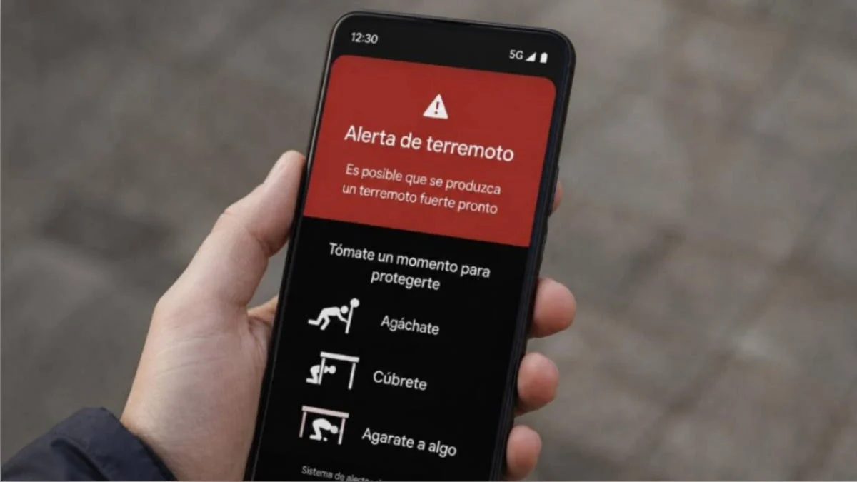
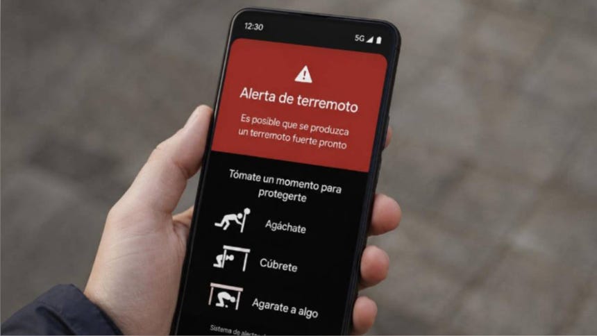
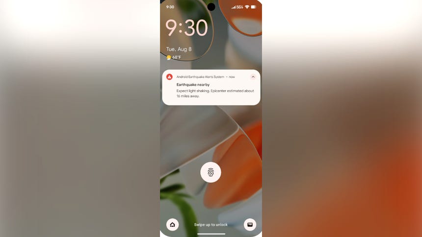
- The Notification: Users located in the potential path of the seismic wave receive a push notification. This alert often arrives seconds before the ground begins to shake, providing critical time to move to a safe zone, drop, cover, and hold on.
How to Enable the Feature: A Step-by-Step Guide
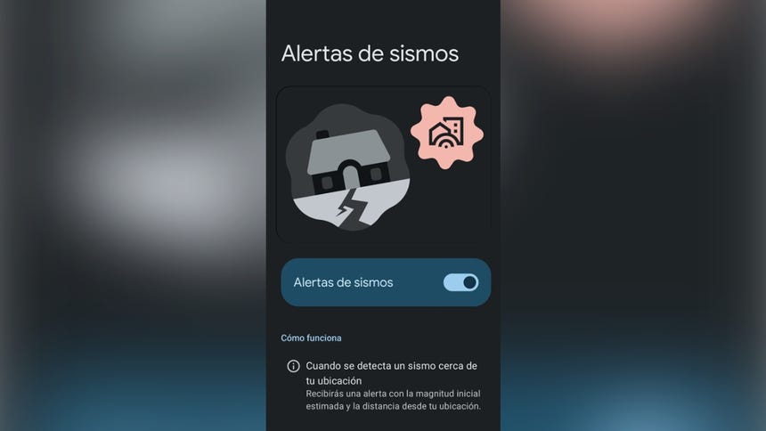
For those residing in high-risk zones, ensuring this feature is active is a simple yet vital step in personal preparedness. Follow these steps to verify your settings:
- Open your device’s "Settings" menu.
- Navigate to "Location."
- Select "Location Services."
- Look for "Earthquake Alerts."
- Ensure the toggle is set to "On."
Note: It is crucial that your location settings and Wi-Fi or data connection are active for the system to function correctly. If you do not see the option, ensure your device’s Android operating system is updated to the latest version.
Digital Integration: Monitoring Seismic Activity via Web
The utility of Google’s platform is not limited to mobile push notifications. Users can also access real-time information through the Google Search engine. By simply typing "earthquake near me" or "terremoto cerca de mí" into the search bar, users are presented with a detailed dashboard provided by the United States Geological Survey (USGS) and other regional monitoring agencies.
This web-based tool provides essential data, including:
- Estimated Magnitude: Information on the intensity of the event.
- Proximity: How far the epicenter is from your current location.
- Safety Advice: Direct links to protocols for what to do during and after a tremor, such as how to prepare an emergency backpack (mochila de emergencia).
Official Responses and Implications for Public Safety
Government agencies and disaster management offices, such as the Instituto Geofísico del Perú (IGP), have largely welcomed these technological advancements, though they emphasize that digital tools should complement, not replace, traditional civil defense protocols.
The Complementary Role of Technology
While Google’s alert system provides an incredible advantage in terms of reaction time, it is not a "magic shield." Official bodies emphasize that the system serves as a "first alert" to help people get into position. The responsibility for long-term preparedness—such as identifying structural weaknesses in homes, maintaining an emergency kit, and participating in civil defense drills—remains with the individual and the community.
Ethical Considerations and Data Privacy
Google has been transparent regarding the privacy of the data used for this system. The information gathered by the accelerometers is anonymized and generalized. The system does not track the identity of individual users, nor does it maintain a history of personal location data linked to the earthquake alerts. The goal is strictly public safety, and the company has implemented robust encryption to ensure that the "mini-sismographs" (the phones) remain private.
The Broader Impact: Building Resilient Communities
The integration of smartphone-based earthquake alerts represents a paradigm shift in how societies manage natural hazards. Historically, seismic early warning systems required expensive, fixed-site sensors that were difficult to maintain and limited in coverage. By crowd-sourcing the sensor network, Google has effectively democratized earthquake safety.
Implications for Urban Planning
The data gathered by this network is also being shared with researchers and urban planners. By aggregating thousands of data points regarding how a city vibrates during a quake, engineers can better understand which zones are most susceptible to soil liquefaction or structural damage. This feedback loop helps create smarter, more resilient cities that are better equipped to withstand future seismic events.
Limitations to Consider
It is important to acknowledge that this technology is still evolving. In very rural areas with low smartphone density, the detection network may be slower to trigger. Furthermore, while it provides a few seconds of warning, those seconds are not always sufficient to evacuate a multi-story building. Consequently, the advice remains consistent: Drop, Cover, and Hold On.
Conclusion: A Tool for Survival
In the high-stakes environment of the Pacific Ring of Fire, the Google Earthquake Alert System serves as a vital component of the modern emergency toolkit. It bridges the gap between the onset of a disaster and human reaction, providing a narrow but invaluable window of time to seek cover.
However, technology is only one part of the equation. To truly mitigate the risks posed by seismic activity, citizens must combine the use of digital tools with a culture of prevention. This includes keeping emergency kits stocked, identifying safe zones in homes and workplaces, and participating in national drill exercises.
As we look to the future, the integration of artificial intelligence and global sensor networks will likely make these warnings even faster and more accurate. Until then, the smartphone in your pocket is far more than a communication device—it is a piece of life-saving infrastructure that, when enabled, keeps you and your community one step ahead of the earth’s next movement.
Stay informed, stay prepared, and ensure your settings are configured to receive these critical alerts. In the face of nature’s volatility, every second counts.