Introduction: Living in the Shadow of the Pacific Ring of Fire
Peru, like many nations along the Pacific Ring of Fire, exists in a state of perpetual seismic vigilance. With over 500 seismic events recorded by the Geophysical Institute of Peru (IGP) in the current year alone, the question is not whether the ground will shake, but when. While most of these events remain unnoticed by the general population due to their low magnitude, the historical precedent of devastating earthquakes in the region serves as a sobering reminder of the necessity for preparedness.
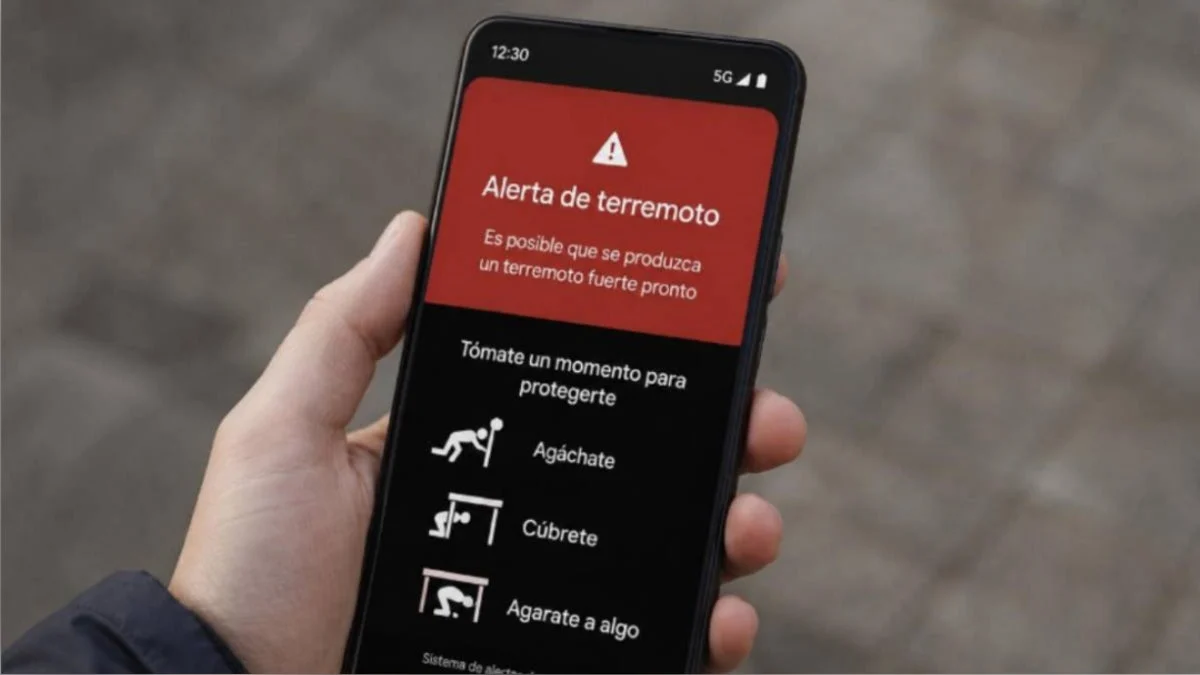
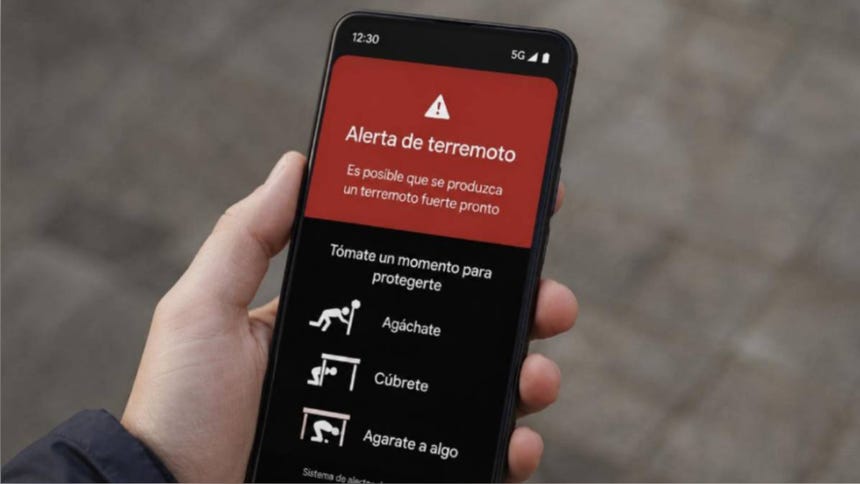
In an era where technology is seamlessly integrated into daily life, smartphones have transcended their role as mere communication devices to become essential tools for survival. Among the most innovative developments in this space is Google’s Earthquake Alerts System. This feature, embedded within the Android operating system, serves as a digital early-warning network, potentially providing citizens with the critical seconds needed to seek shelter, step away from hazardous areas, or drop, cover, and hold on.
Understanding the Technology: How Your Phone Becomes a Seismometer
The mechanism behind Google’s earthquake alert system is a testament to the power of crowdsourced data. At its core, the technology relies on the ubiquitous hardware already present in virtually every modern smartphone: the accelerometer.
The Accelerometer as a Sensory Tool
Every Android smartphone is equipped with a tiny accelerometer—a sensor designed to detect changes in motion and orientation. These sensors are what allow your phone to rotate the screen when you turn it sideways or track your steps during a workout. However, in the context of geology, these sensors are sensitive enough to detect the characteristic wave patterns of an earthquake.
The Global Network
When an earthquake occurs, it sends out two types of waves: P-waves (primary) and S-waves (secondary). P-waves travel faster and are generally less destructive. Google’s system is designed to detect these initial P-waves. When a phone detects vibrations consistent with an earthquake, it sends a signal to Google’s detection server, including the approximate location of the epicenter.
By aggregating data from over two billion Android devices globally, Google has effectively created the world’s largest distributed seismometer network. When a significant number of phones in a specific geographic area report similar vibrations, the system confirms the event and immediately broadcasts a warning to other Android users in the affected path, often arriving seconds before the more destructive S-waves reach the location.
Chronology of Seismic Awareness in Peru
To understand why such tools are vital, one must look at the seismic history of Peru. The nation’s geography is defined by the subduction of the Nazca Plate beneath the South American Plate, a process that accumulates immense pressure over decades.
- 1746: The catastrophic Callao earthquake and subsequent tsunami remain a benchmark for the destructive potential of the region.
- 1970: The Ancash earthquake demonstrated the secondary dangers of seismic activity, specifically the massive landslides that buried the city of Yungay.
- 2007: The Pisco earthquake highlighted the need for modernizing construction standards and public communication systems.
- The Present Day: We are in an era of "digital readiness." The integration of Google’s alert system represents the latest phase in a long evolution of disaster risk reduction, moving from manual sirens and radio broadcasts to instant, location-specific mobile notifications.
Step-by-Step: Activating Your Digital Shield
For residents in high-risk zones, ensuring that this feature is enabled is a fundamental step in personal safety. The process is straightforward, yet often overlooked by users who assume the feature is active by default.
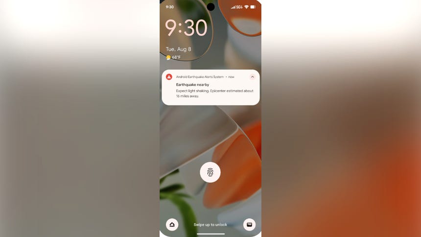
How to Enable Earthquake Alerts on Android
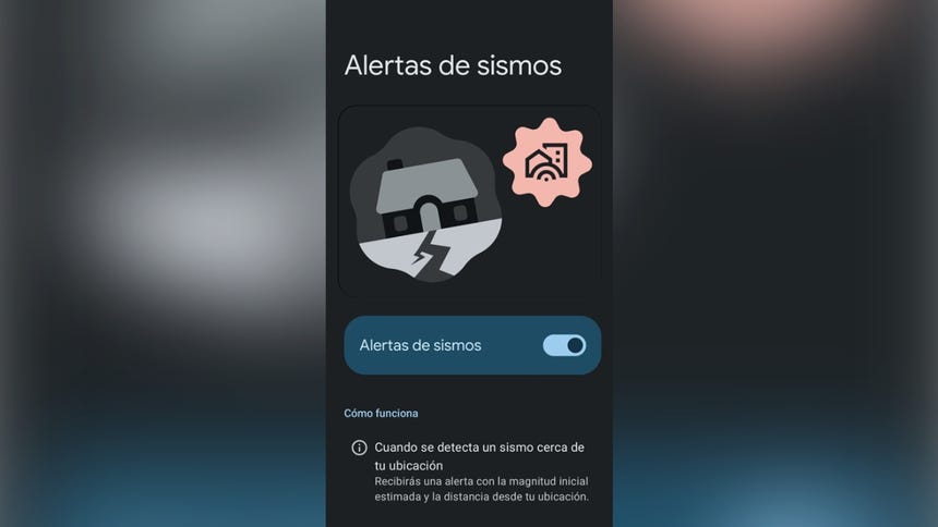
- Access Settings: Open the "Settings" application on your Android device.
- Navigate to Location: Scroll down to the "Location" menu.
- Advanced Settings: Tap on "Advanced" or "Location Services."
- Earthquake Alerts: Select "Earthquake Alerts." Ensure the toggle is switched to the "On" position.
- Simulated Demo: Within this menu, you can usually trigger a "See a Demo" option to familiarize yourself with the sound and visual interface of an actual alert, ensuring you aren’t caught off guard when a real notification arrives.
Web-Based Monitoring
Beyond mobile alerts, users can also leverage Google’s search engine to verify seismic activity in real-time. By searching for "earthquake near me" or "terremoto cerca de mí" after experiencing a tremor, users are directed to a specialized interface that displays the magnitude, depth, and epicenter location of the event, providing immediate situational awareness.
Supporting Data: Why Seconds Matter
In seismic engineering and disaster management, the "Golden Seconds" are the interval between receiving an early warning and the arrival of the most violent shaking.
According to data from the United States Geological Survey (USGS) and international seismological agencies, even 10 to 30 seconds of warning can significantly reduce injury rates. These seconds allow for:
- Automated Safety: Industrial systems can shut down gas lines or halt elevators.
- Human Response: Individuals can move away from windows, heavy furniture, or glass facades.
- Institutional Safety: Schools and offices can initiate "Drop, Cover, and Hold On" protocols, which are statistically proven to save lives during structural failure.
While the system is not a predictor—it cannot tell us when an earthquake will happen—it is a powerful tool for detecting it the moment it begins, providing a crucial buffer for human reaction.
Official Responses and Limitations
While the scientific community and civil defense organizations, such as the Instituto Nacional de Defensa Civil (INDECI), applaud the use of technology, they emphasize that these tools are not a substitute for physical preparedness.
The Role of INDECI
INDECI reminds citizens that an application or a mobile alert is only one layer of a broader strategy. The "Mochila de Emergencia" (Emergency Backpack) remains the cornerstone of survival. An alert gives you the time to reach your emergency kit, but it does not provide the water, food, radio, or first-aid supplies required for the critical hours following an event.
Limitations of the System
It is imperative to understand the technical limitations of Google’s system:
- Dependency on Connectivity: The system requires an active data connection or Wi-Fi to receive the server-side alert once the event is verified.
- Proximity to Epicenter: If you are located at the very epicenter of a shallow earthquake, the P-waves and S-waves may arrive almost simultaneously, leaving no time for the system to process and deliver a warning.
- Hardware Requirements: The system is exclusive to Android devices and requires Google Play Services. It is not a replacement for government-issued national alert systems, which utilize cell broadcast technology to reach all mobile phones regardless of operating system.
Implications for the Future
The widespread adoption of crowdsourced seismic detection marks a shift toward "Community-Driven Resilience." By turning the population into a network of sensors, we are effectively decentralizing the burden of disaster detection.
In the future, we can expect this technology to integrate more deeply with "Smart City" infrastructure. Imagine a scenario where a Google Earthquake Alert not only notifies your phone but automatically dims the streetlights, notifies emergency services of the exact location of the epicenter, and signals public transit systems to bring trains to a safe stop.
A Call to Action
Technology is a force multiplier, but it is not a cure-all. The responsibility for safety rests with the individual. We urge all readers to:
- Verify your settings: Ensure your Android device is updated and the alert feature is active.
- Participate in drills: Familiarize yourself with evacuation routes in your home and workplace.
- Prepare your supplies: Maintain a fully stocked emergency backpack.
The earth beneath us is constantly in motion. While we cannot prevent the shifting of tectonic plates, we can, through a combination of traditional preparedness and modern digital tools, ensure that when the next event occurs, we are as ready as we can possibly be. Stay informed, stay prepared, and keep your devices ready to protect you.