Peru sits squarely within the "Ring of Fire," a vast, horseshoe-shaped area of the Pacific Ocean where the majority of the world’s seismic and volcanic activity occurs. For the residents of this region, earthquakes are not a theoretical risk but a recurring reality. With over 500 seismic events reported by the Geophysical Institute of Peru (IGP) so far this year, the necessity for proactive emergency measures has never been higher.
In an era where mobile technology is omnipresent, Google has leveraged its massive Android user base to create one of the most sophisticated, large-scale early warning systems in history. This report details how this tool functions, why it is critical for survival, and how you can ensure your device is prepared to provide those life-saving seconds of warning.
The Mechanics of Detection: How Google’s Network Functions
The Google Earthquake Alert System is a free, innovative tool integrated directly into the Android operating system. Unlike traditional seismic networks that rely exclusively on expensive, sparse, and stationary government-run seismometers, Google’s approach turns every smartphone into a miniature, portable seismometer.
The Role of Accelerometers
Modern smartphones are equipped with small, highly sensitive sensors known as accelerometers. These components are primarily used to detect the orientation of your phone, but they are also sensitive enough to detect the characteristic vibrations produced by the P-waves (primary waves) of an earthquake—the initial, often faster-moving waves that precede the more destructive S-waves (secondary waves).
A Global Network of "Minisismometers"
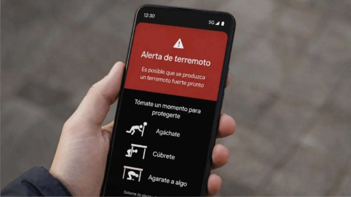
When an Android phone detects a potential seismic event, it sends a signal to Google’s earthquake detection servers. This signal includes an approximation of the epicenter and the intensity of the vibration. Because there are over two billion Android devices active worldwide, this network creates a dense, high-fidelity mesh capable of triangulating seismic activity in real-time. Once the system confirms a pattern consistent with a tectonic event, it broadcasts an alert to all Android devices in the affected radius. This allows users to receive a warning seconds—sometimes even a full minute—before the shaking begins, providing a crucial window to take cover.
A Chronology of Seismic Awareness in Peru
The integration of technology into disaster risk reduction (DRR) in Peru has been a gradual but essential process.
- Pre-2010s: Public awareness relied heavily on traditional sirens and radio broadcasts, which often arrived after the shaking had already peaked.
- 2019-2020: The rise of mobile apps and the implementation of early-warning algorithms began to change the landscape. Google began rolling out its Android-based detection system, initially testing it in seismic hotspots.
- 2021-2023: As the system matured, Google expanded the reach of these alerts globally, specifically targeting countries within the Ring of Fire. This period saw a significant shift in public reliance from government-only alerts to a "layered" approach, where private-sector technology supports public infrastructure.
- 2024-Present: Today, the integration is seamless. With the increasing frequency of minor and moderate tremors in Peru, the Google system has become a standard, passive safety feature for millions of citizens, operating silently in the background until it is needed most.
Supporting Data: The Vital Seconds
Why are these warnings so effective? The answer lies in the physics of wave propagation.
Seismic waves travel through the Earth’s crust at high speeds, but electromagnetic waves (the signals sent to your phone) travel at the speed of light. Even with the lag time of processing a signal, the data can reach a phone in a neighboring city or district before the physical tremors arrive.
- The "Cover, Hold, and Protect" Window: Studies by the U.S. Geological Survey (USGS) and other global seismological agencies suggest that even a 10-second warning is sufficient to move away from windows, drop under a sturdy table, or stop a vehicle safely.
- Data Volume: The IGP reports show that while most of the 500+ earthquakes in Peru this year have been low-magnitude or deep-crustal events causing no damage, the "noise" created by these events helps train and calibrate the detection algorithms, making the system more accurate for high-magnitude, shallow-depth events that pose the greatest risk to infrastructure.
How to Enable the System on Your Device
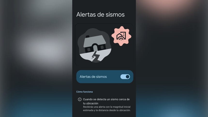
To ensure you are receiving these life-saving alerts, follow these steps to configure your Android device:
- Open Settings: Navigate to your phone’s "Settings" menu.
- Access Safety Features: Look for the "Safety and Emergency" or "Location" tab. Depending on your Android version, it may be under "Location" -> "Advanced" -> "Earthquake Alerts."
- Toggle the Switch: Ensure the "Earthquake Alerts" button is set to "On."
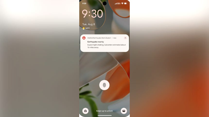
- Test and Verify: You can trigger a demo alert from this same menu to familiarize yourself with the sound and vibration, ensuring that your volume is loud enough to wake you at night.
Note: Ensure your device has Location Services enabled, as the system requires your geographic position to determine if you are in the path of the approaching wave.
Official Responses and Public Integration
The government of Peru and various international organizations, including the United Nations Office for Disaster Risk Reduction (UNDRR), have emphasized that technology is not a replacement for traditional civil defense measures.
The "Layered" Safety Approach
Official agencies, such as the Instituto Nacional de Defensa Civil (INDECI), stress that while Google’s tool is an excellent auxiliary, it must be used alongside official channels. Citizens are encouraged to:
- Maintain a well-stocked emergency backpack (mochila de emergencia).
- Participate in national seismic drills (simulacros).
- Identify safe zones within their homes and workplaces.
The official consensus is that mobile alerts serve to reduce panic and increase the efficiency of evacuation protocols, but they do not eliminate the need for physical preparedness.
Implications for the Future: Beyond Detection
The success of the Google Earthquake Alert System has broad implications for future disaster management:
1. The Democratization of Safety
In the past, advanced earthquake early warning (EEW) systems were reserved for the wealthiest nations with the resources to install thousands of high-cost seismic sensors. By crowdsourcing data, Google has effectively democratized safety, bringing the same level of warning to developing regions that previously lacked the infrastructure for large-scale alert systems.
2. Enhancing Disaster Resilience
The integration of real-time data allows for "smart city" responses. Future implementations may involve the automatic triggering of smart home devices—such as shutting off gas valves, unlocking smart doors, or turning off elevators—seconds before an earthquake, further reducing the risk of fire and structural entrapment.
3. Challenges and Limitations
While powerful, the system is not infallible. Dense urban areas with high concentrations of devices provide the most accurate data. In rural or sparsely populated areas, the lack of sufficient Android devices can delay the detection of a tremor. Furthermore, the system is entirely dependent on the stability of the mobile network, which could be compromised in a catastrophic event.
Conclusion: A Proactive Stance
Living in a seismic zone like Peru requires a mindset of constant readiness. While we cannot predict the exact moment a major earthquake will strike, we can certainly use the tools at our disposal to mitigate the danger.
Google’s Earthquake Alert System is an essential, free layer of defense that every Android user in Peru should have enabled. By combining this technology with the traditional staples of disaster preparedness—such as a ready-to-go emergency kit and a clear family evacuation plan—citizens can significantly improve their odds of navigating the challenges of living on the Ring of Fire.
Remember, the goal of these alerts is not to induce fear, but to provide the clarity needed to act decisively. Take a moment today to check your settings; those few seconds of warning could be the most important seconds of your life.
For more information on how to prepare for seismic events in your local area, consult the official guidelines provided by INDECI and the Geophysical Institute of Peru (IGP). Always stay informed through verified news sources and official government channels.